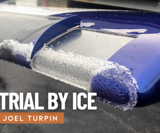
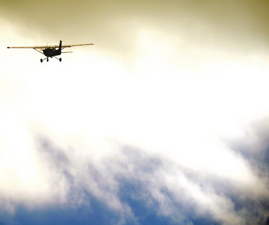
Remove Altimeter Remove Runway Remove VOR
article thumbnail

Trial by Ice

Air Facts

Just north of Jefferson City, the Kansas City Center controller cleared us to the Jeff City VOR, which was on the airport, to hold at 4,000 feet. I got out my instrument approach chart and studied the holding pattern and the VOR approach procedure. In eight minutes, we would be a pile of bent aluminum in some field short of the runway.

VOR 52
article thumbnail

The Day I Learned to Trust My Instruments

Air Facts

Taxiing to Runway 06, I ran through the before-takeoff checklist: fuel selector both, flaps up, mixture rich, lights on. I tuned the Manila VOR to confirm my position and set up the next waypoint. I focused on the panel: attitude indicator, heading indicator, altimeter. I filed my flight plan and headed out. Trust the tools.

Insiders

Sign Up for our Newsletter

This site is protected by reCAPTCHA and the Google Privacy Policy and Terms of Service apply.

Trending Sources

article thumbnail

RNAV Approaches Simplified: A Guide for New Pilots

Pilot Institute

Before RNAV, pilots had to rely on radios (NAVAIDs) and antennas on the ground such as VORs (Very High-Frequency Omnidirectional Range) and NDBs (Non-Directional Beacons). Lateral guidance tells you to go left or right to align yourself with the runway. If you dont see the runway before reaching MOLRE, you have to go missed.

article thumbnail

Holding Procedures – Airplane Holding Patterns Easily Explained

Pilot Institute

Pilots use holds for traffic delays, weather, emergencies, planning, or runway changes. Runway Changes (or Closure) Where possible, airplanes normally like to land in the wind. If the wind changes significantly, the airport authority may decide to change the runway. Yep, those runway numbers do mean something. Is that it?

article thumbnail

MDA vs. DA Made Simple: A Guide to IFR Minimums

Pilot Institute

Pilots use special paths called IFR approaches to help them line up with the runway. Minimums are the lowest height you can go without seeing the runway. Both MDA and DA are measured from sea level, just like the altimeter in the airplane. This is like DA but measured from the runway’s height above sea level.

article thumbnail

HSI vs. CDI: What’s the Difference?

Pilot Institute

You can use the CDI with navigation aids like VOR (VHF Omnidirectional Range) or GPS. We wont explain technical details, so you may not understand the example if you havent used a VOR. Imagine were flying an HSI-equipped airplane away from VOR. Q: What is the difference between a VOR and a HSI? What would you say to them?

VOR 52
article thumbnail

Passing Your Private Pilot Check Ride Requires the Right Preparation

Flying Magazine

So, for example, if you are asked to provide a scenario when V X is appropriate, be able to answer the when and the why, such as “short field takeoff technique is appropriate when there is an obstacle off the departure end of the runway.” Application, correlation, and understanding are critical when it comes to aircraft systems.

Pilot 116