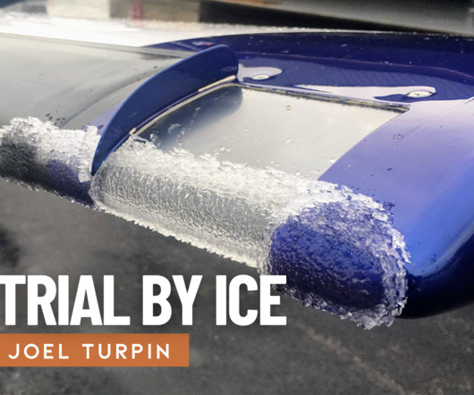
Remove Clearance Remove Flight Plan Remove VOR
article thumbnail

Trial by Ice

Air Facts

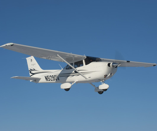
The Cessna 150 Since I was the only instrument rated pilot on the team, and the weather was marginal VFR, I chose to fly the 172, N7358G, up to Fairfield on an IFR flight plan above the clouds at 7,000 feet. My IFR flight plan called for a climb through some 4,000′ of clouds up to a cruise altitude of 7,000 feet.

VOR
article thumbnail

Flight Instruments vs. Avionics

WayMan

The main collection, commonly known as the “six-pack,” gives the primary flight parameters: Airspeed Indicator (ASI): Airspeed Indicator shows the speed of the aircraft with respect to the surrounding air mass, an important parameter for all flight phases.

Insiders

Sign Up for our Newsletter

This site is protected by reCAPTCHA and the Google Privacy Policy and Terms of Service apply.

Trending Sources

article thumbnail

Experience in the Chair: Guiding a Twin Beech Home

Air Facts

The equipment was often not much modernized from the military days so the pilots likely hoped for good weather as they filed their flight plans. The longest runways had front course and back course ILS (Instrument Landing Systems) and an on-field VOR that provided navigation and approach capabilities for aircraft on instrument flights.

article thumbnail

How to Choose the Best Alternate Airport for Your IFR Flight: A Pilot’s Guide

Flight Training Central

IFR Alternate Airport Planning While every IFR flight requires you to file an IFR flight plan and receive an ATC clearance, not every flight is flown in IFR conditions. While every IFR flight requires you to file an IFR flight plan and receive an ATC clearance, not every flight is flown in IFR conditions.

article thumbnail

Drone Lingo Simplified: Acronyms Every Pilot Needs To Know

Pilot Institute

In contrast to a control tower, an FSS is not responsible for giving instructions or clearances to aircraft. Pilots are required to check for NOTAMs along their relevant routes or locations before the start of a flight. TFRs are published in real-time and can be checked using drone flight planning apps or via LAANC.

article thumbnail

The Day I Learned to Trust My Instruments

Air Facts

I filed my flight plan and headed out. With takeoff clearance from the tower, I pushed the throttle forward. I tuned the Manila VOR to confirm my position and set up the next waypoint. The METAR and TAF showed CAVOK along most of the route, with a mention of scattered clouds near Bohol by late morning.

article thumbnail

Quiz: Airspace classifications and rules

Flight Training Central

To operate in Class D airspace, you must: Be in contact with ATC and have a clearance to enter. A temporary flight restriction (TFR) may be issued for: Areas around major sporting events below 3,000 AGL and within 3 nautical miles. VOR/DME must complete an online course covering flight operations in the D.C.