Remove Approach Remove Density Altitude Remove Indicated Airspeed
article thumbnail

Go-Around Required

Plane and Pilot

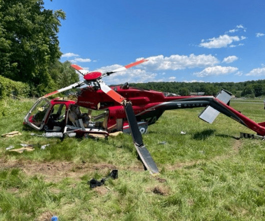
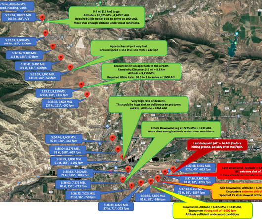
The Bonanza lay crumpled up in an empty lot just 2,400 feet from the approach end of the runway. While it wasn’t a particularly hot day, Big Bear’s density altitude was reported as 8,200 feet, resulting in a higher true airspeed compared to indicated airspeed. Moments later, the airplane crashed.

article thumbnail

Unbolted in Fairfield (Update on the 2022 Bell 407 GXP Crash)

Fear of Landing

As the helicopter continued towards the airport, the airspeed began to decrease. The indicated airspeed had fallen below 65 knots and was still decreasing. As the airspeed decayed, the right yaw increased. The helicopter was at treetop height with an indicated airspeed of zero knots when the right yaw ceased.

Insiders

Sign Up for our Newsletter

This site is protected by reCAPTCHA and the Google Privacy Policy and Terms of Service apply.

Trending Sources

article thumbnail

What NTSB Reports Say About Impossible Turns and Angle of Attack

Air Facts

This broad scope approach is ultimately needed to help keep our friends, created in the image of God, alive. The current emphasis in general aviation (GA) safety is on visual angle of attack (AOA) indicators and impossible turns (return to the airport following engine failure). I can teach you in five minutes.”

article thumbnail

How to fly the perfect short field takeoff and climb

Flight Training Central

But remember high density altitude reduces performance and therefore increases takeoff rolls, and degrades climb performance. Taxi the aircraft into position, centered on the runway with the nosewheel straight, as close to the approach end as possible.Hold the brakes, preventing any movement of the aircraft.

article thumbnail

Invisible Trap Kills Glider Pilot – How To Avoid Microbursts

Chess In the Air

At 5:12 pm, 5 hours and 12 minutes into the flight, Shmulik was 10 miles north of the airport of Meeker, CO at an altitude of 14,300 ft, when he decided to turn south, back towards Rifle, ~45 miles away. Less than 20 minutes later he was about 9 miles north of Rifle at an altitude of 10,000 ft, continuing south and preparing to land.