article thumbnail

Teaching International Student Pilots

Air Facts

Teaching International Student Pilots Air Facts Journal In the mid 70s, I was a USAF T-38 instructor pilot (IP) in the 71 st Flying Training Wing at Vance AFB (KEND) in Enid, Oklahoma. Two squadrons trained students in their journey to become Air Force pilots. The venerable Tweet A.K.A. The 6000-pound dog-whistle!

Pilot 98
article thumbnail

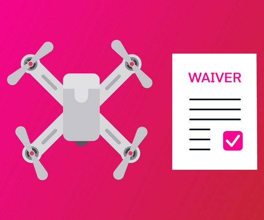
Understanding the FAA’s DROTAM

CFI Academy

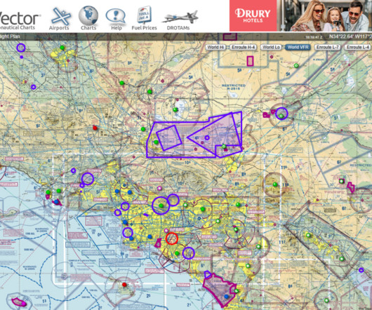
As an airplane pilot, youre familiar with NOTAMs, but have you encountered a DROTAM? They notify you when and where drone operatorsthink utility companies or filmmakersare flying, typically at low altitudes (below 400 feet AGL). We do get occasional DROTAMs here, which are usually for upto 400′ AGL.

AGL 99
Insiders

Sign Up for our Newsletter

This site is protected by reCAPTCHA and the Google Privacy Policy and Terms of Service apply.

Trending Sources

article thumbnail

Radar, FDR Disagree On DC Blackhawk Altitude

AV Web

At a press briefing on Saturday, NTSB member Todd Inman said the flight data recorder and ADS-B data put the regional jet at 325 feet AGL at the point of impact, plus or minus 25 feet while the controller’s console showed the helicopter at 200 feet, the ceiling of the flight corridor it was flying at the time.

AGL 134
article thumbnail

How to Read METAR and TAF Reports

Pilot Institute

With the rise in the prevalence of drone flight, drone pilots are now at a stage where they are expected to operate within long-established aviation standards. To this end, drone pilots are expected to understand weather forecasts in the form of METAR and TAF reports. Key Takeaways METAR and TAF provide vital weather info for pilots.

AGL 98
article thumbnail

Terminal Radar: It’s the Weather Pilots Don’t See

Flying Magazine

Many other technologies are at workalbeit unseen, but critical to get the pilot back on the ground safely. Subscribe Now During the warm season when convective SIGMETs outnumber all other advisories, many pilots cant seem to get enough ground-based weather radar images from the WSR-88D NEXRAD Doppler radars. Heres the problem.

Weather 80
article thumbnail

Types of Pilot Licenses Explained (Student, Recreational, Private, Commercial, ATP, and more)

Pilot Institute

Pilots can have multiple licenses. Each license gives a pilot different privileges. Pilots usually start by getting their Private Pilot license and then work towards a commercial pilot license if they are interested in being a pilot as a career. But its a necessary step to obtain higher pilot certification.

Pilot 86
article thumbnail

Wild Alaska

Plane and Pilot

The terrain reaches well over 4,000 feet agl, so a good vertical rise is seen. It is reminiscent of Montana, where I have been often in real life on flying trips, and while there aren’t towering mountains like the Tetons, it is dangerous enough for foolhardy pilots indeed. The density of the forest was incredible.

AGL 98