Remove Ceiling Remove Descent Remove Flight Plan
article thumbnail

Long Trips & Small Airplanes

Plane and Pilot

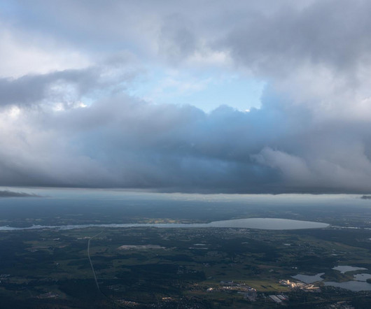
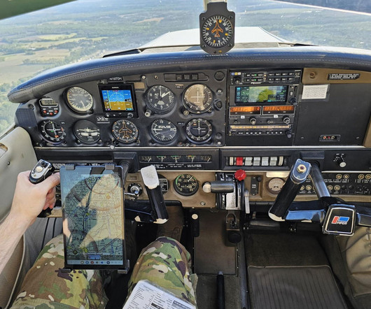
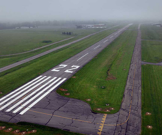
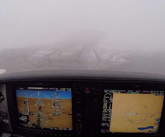
Maybe it’s the Georgia flying weather, or maybe it’s the ever-increasing emphasis on “old” pilot instead of “bold” pilot, but it seems that flight planning these days is a lot more about if and when than about route and altitude. It’s only two hours by RV-9A, but there are gotchas lurking in the flight planning.

article thumbnail

How an EFB Helps Private Pilots Transition to IFR Flying

Flying Magazine

He lost 200 feet before even noticing the descent. One of the most essential tools for staying ahead of the airplane is the electronic flight bag (EFB). You likely became introduced to an EFB as a student pilot and probably use one for basic flight planning tasks as a VFR pilot, but using one in instrument flight is different.

Pilot 104
Insiders

Sign Up for our Newsletter

This site is protected by reCAPTCHA and the Google Privacy Policy and Terms of Service apply.

Trending Sources

article thumbnail

Trial by Ice

Air Facts

The Cessna 150 Since I was the only instrument rated pilot on the team, and the weather was marginal VFR, I chose to fly the 172, N7358G, up to Fairfield on an IFR flight plan above the clouds at 7,000 feet. My IFR flight plan called for a climb through some 4,000′ of clouds up to a cruise altitude of 7,000 feet.

VOR 52
article thumbnail

Quiz: Regulations for Instrument Flight Rules

Flight Training Central

However, during the descent on an ILS approach, you encounter VMC prior to reaching the initial approach fix. To log the approach toward instrument currency the flight must remain on an IFR flight plan throughout the approach and landing. For a flight in VFR conditions while on an IFR flight plan.

article thumbnail

“Totally a visibility issue.”

Fear of Landing

A few hours later, the pilot obtained a weather briefing and filed an IFR flight plan before departing Westchester to fly back to Montgomery County. By now, it was dark and the weather in Gaithersburg had deteriorated with fog and low cloud ceilings. Montgomery County Airpark (GAI) is at about 540 feet above mean sea level.

article thumbnail

Choosing an IFR Alternate Airport

Northstar VFR

Flight planning becomes more advanced than before, flying SIDs and STARs, and instrument approaches. But a crucial part of this flight planning is planning for the worst case scenario: What if you can’t land at your original destination? When MUST I Plan for an Alternate?

article thumbnail

Riding the Mountain Waves

Plane and Pilot

Often, turbulence is the harbinger of mountain waves, not the ideal ceiling—and visibility unlimited—day. Flight idle and nose down, which normally produced a 2,000-3,000-feet descent rate, resulted in a 2,000-feet-per-minute climb. We continued our descent into Great Falls, leaving “the wave” behind and above.